


The Landscape
Panama’s geological story began about three million years ago when volcanic islands gradually rose from the oceans and joined together, forming an isthmus —a narrow land bridge that connects North and South America. This event reshaped the planet by altering ocean currents, influencing global climate, and enabling plants and animals to migrate between the continents. Today, Panama lies at the intersection of four tectonic plates, making it one of the most geologically active regions in the Americas, with frequent earthquakes and several active volcanoes.
The Geography
This S-shaped isthmus also separates the Caribbean Sea from the Pacific Ocean. Its varied landscape includes rugged volcanic mountains, rolling upland plains, hundreds of rivers, broad coastal lowlands, and numerous offshore islands. A tropical climate brings warm temperatures and high humidity throughout the year, with a rainy season that generally lasts from May through November. Though only about the size of South Carolina, Panama is home to an extraordinary diversity of plants and animals, making it one of the most biologically rich countries in the world.
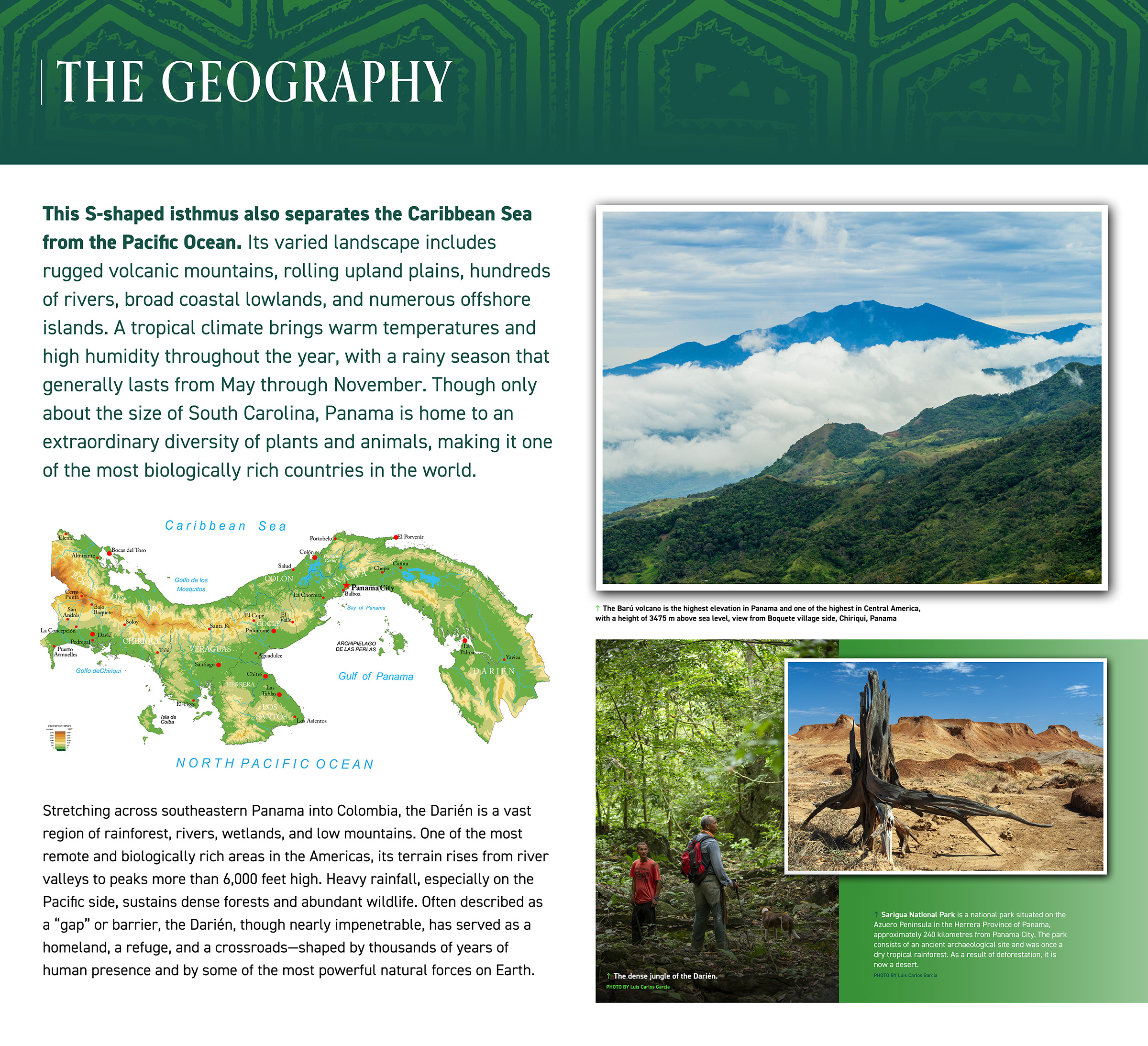
Stretching across southeastern Panama into Colombia, the Darién is a vast region of rainforest, rivers, wetlands, and low mountains. One of the most remote and biologically rich areas in the Americas, its terrain rises from river valleys to peaks more than 6,000 feet high. Heavy rainfall, especially on the Pacific side, sustains dense forests and abundant wildlife. Often described as a “gap” or barrier, the Darién, though nearly impenetrable, has served as a homeland, a refuge, and a crossroads—shaped by thousands of years of human presence and by some of the most powerful natural forces on Earth.
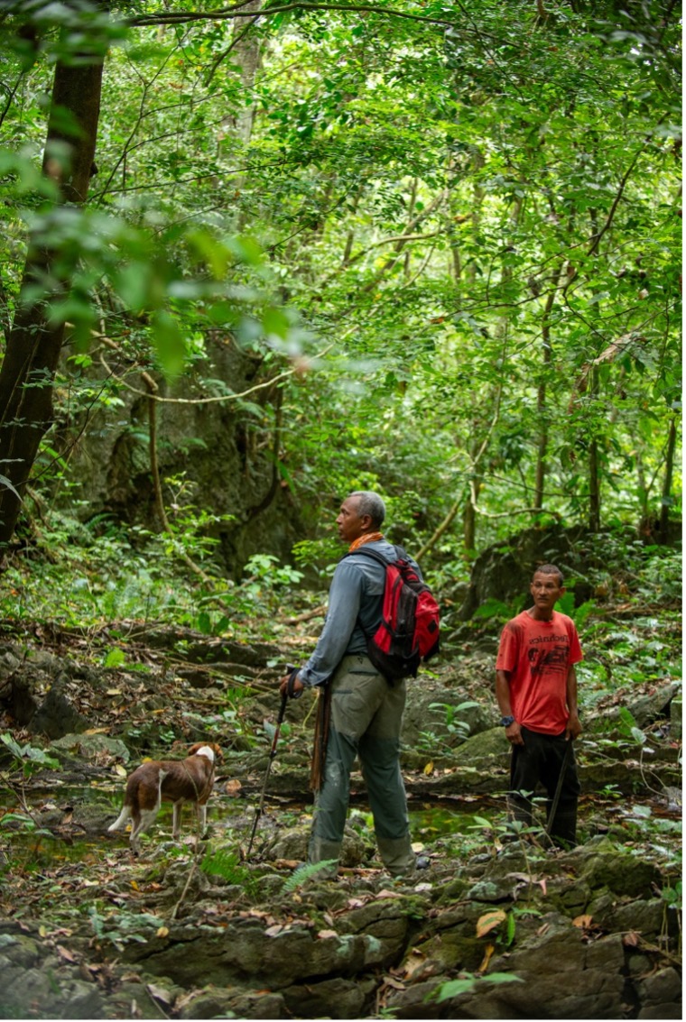
In the dense jungle of the Darién
Photo: Luis Carlos Garcia
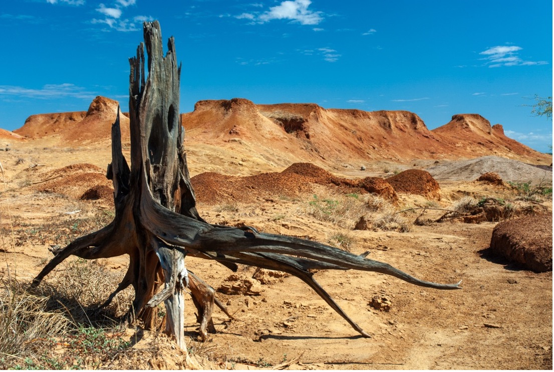
Sarigua National Park. Photo by Luis Carlos Garcia.
Sarigua National Park is situated on the Azuero Peninsula in the Herrera Province of Panama approximately 240 kilometers from Panama City. The park consists of an ancient archaeological site and was once a dry tropical forest. As a result of deforestation, it is now a desert.
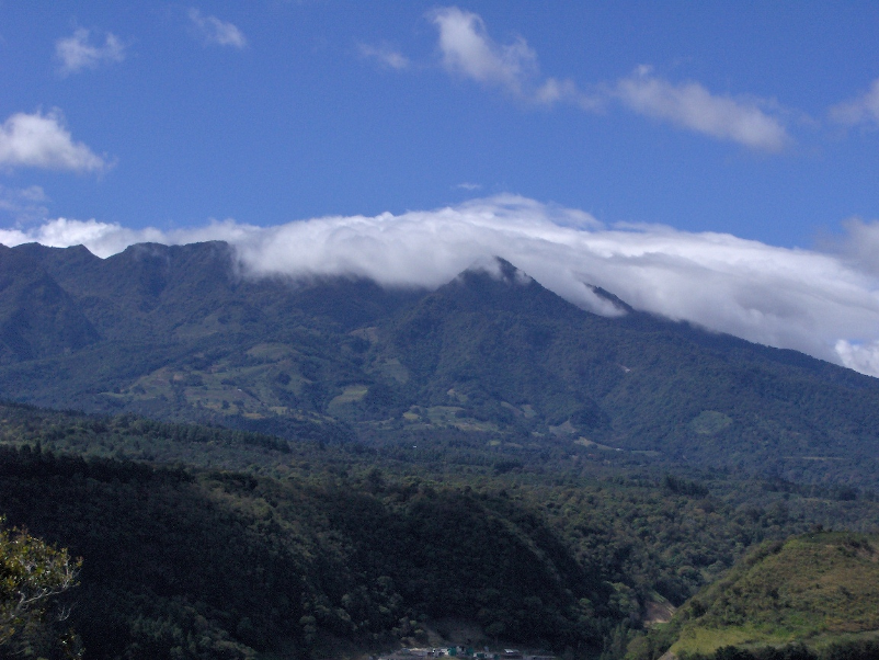
Barú Volcano. Photo by Desi burgos / Wikimedia Commons, public domain.
The Barú volcano is the highest elevation in Panama and one of the highest in Central America, rising to 3475 m above sea level, View from Boquete village side, Chiriqui, Panama. Photo: Desi burgos / Wikimedia Commons, public domain.