


Building The Panama Canal
“The creation of the Panama Canal was far more than a vast, unprecedented feat of engineering. It was a profoundly important historic event and a sweeping human drama not unlike that of war. Apart from wars, it represented the largest, most costly single effort ever before mounted anywhere on earth. It held the world’s attention over a span of forty years, …affected the lives of tens of thousands of people at every level of society and of virtually every race and nationality.” David McCullough, The Path Between the Seas p. 11
The Dream
In the 1880s, French engineers—fresh from building the Suez Canal—launched the first modern attempt to construct a canal in Panama. The French believed that they could accomplish what they had done in Egypt – dig a sea-level channel that would connect the two seas. Unlike the Suez, the project in Panama had to cross dense rainforest and mountainous terrain. Landslides and flooding slowed progress and yellow fever and malaria took the lives of over 20,000 workers. Financial scandal eventually ended the effort, but the French left behind surveys, excavations and equipment that would later prove useful.
By 1903, the United States was poised to make its own efforts to build a Panama Canal. However, Panama was still a province of Colombia, which rejected a treaty to give the U.S. rights to canal construction. When a simmering movement advocating for independence resulted in Panamanian leaders declaring independence from Colombia, the U.S. Navy moved quickly to block Colombian troops from landing. The United States recognized Panama as a new nation within days. Soon after, Panama signed a treaty granting rights to and defense of the Panama Canal Zone (the canal and approximately five miles on each side of the centerline but excluding Panama City and Colón). This treaty gave the US some rights to the canal “in perpetuity,” but limited other rights to a lease period of 99 years.
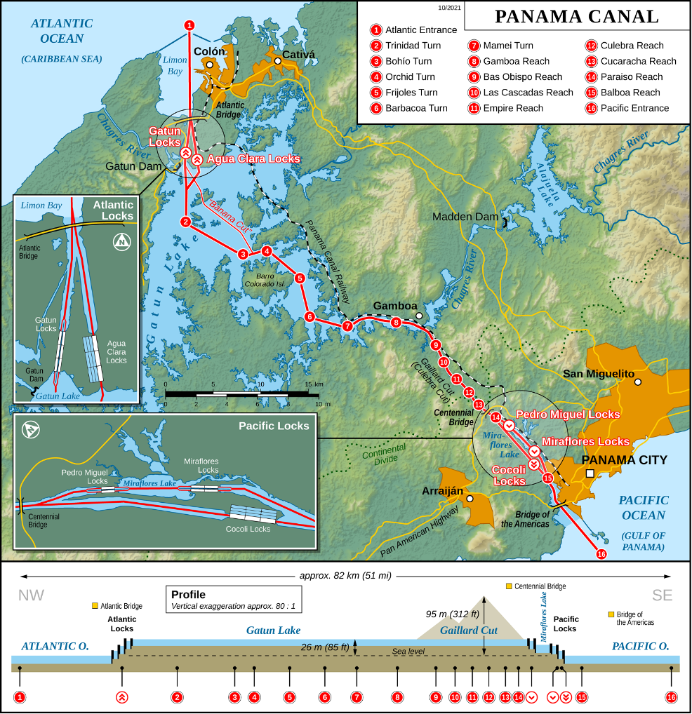
U.S. engineers abandoned the idea of a sea-level canal and instead focused their efforts on building a lock-based system. The Erie Canal (U.S.), the Welland Canal (Canada), and the Caledonian Canal (Scotland) had demonstrated that dramatic height differences could be managed using massive locks. An enormous earthen dam was built on the Chagres River to create Gatun Lake, then the largest artificial lake in the world. Ships use the lake to cross about 21 miles (33 km) of the distance across the Isthmus.
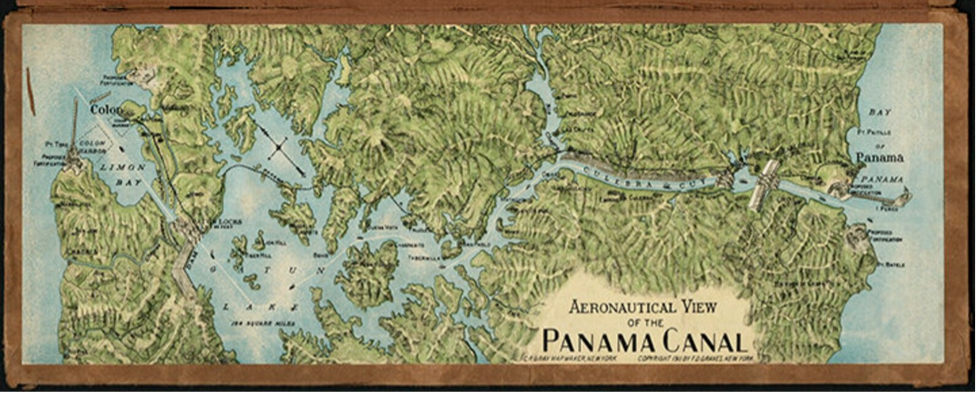
Aeronautical View of the Panama Canal
C. P. Gray, cartographer
Reproduction of 1911 Souvenir Map
Published by F. D. Graves, New York
Created as the canal neared completion, this map illustrates the route before the Panama Canal officially opened in 1914.
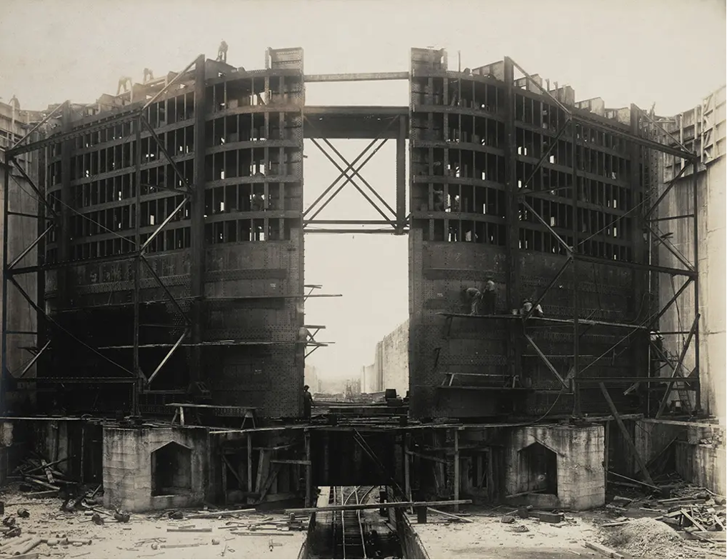
Building a set of lock gates at Gatun. The massive gates of the Panama Canal were built using steel from Jones and Laughlin Steel Company of Pittsburgh and cement from the Lehigh Valley of Pennsylvania. Each “leaf” of a pair of steel lock gates is massive. The leaves are 65 feet wide and 7 feet deep, but the height varies from 47 to 82 feet, depending on location. The steel gates are hollow and built as a series of water-tight compartments like a ship, so when the locks are filled, the gates are buoyant. These locks functioned until 2016 when they were replaced. Image source: Nichols, Aurin Bugbee, and Tirzah Lamson Nichols. Panama Canal Collection, 1846-1923 (bulk 1906-1914). Photograph Album 3, p. [29].
Step by Step
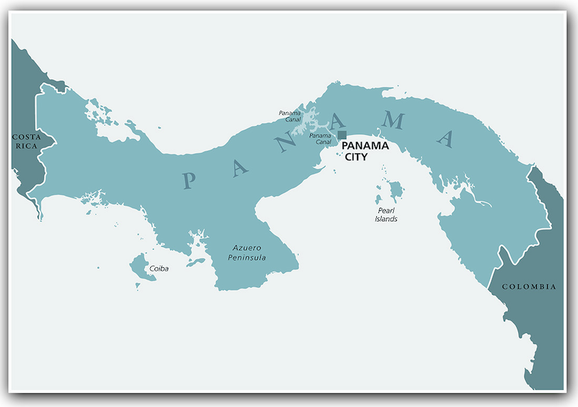
The Culebra Cut—later renamed the Gaillard Cut—was the most challenging and dangerous section of construction on the Panama Canal. Before construction, a ridge of the Continental Divide rose about 360 feet (110 meters) above sea level, posing the greatest natural barrier to a canal. Between 1904 and 1914, workers used steam shovels, drills, dynamite, and the railroad to remove more than 75 million cubic yards of earth and rock. Tropical rains caused landslides that repeatedly collapsed into the cut. Eventually, when the canal opened, the floor of the Cut was about 85 feet (26 meters) above sea level, the level of Gatun Lake. Two lock systems on the Pacific and one on the Atlantic side are able to raise ships up to the level of Gatun Lake and then lower them back to sea level.
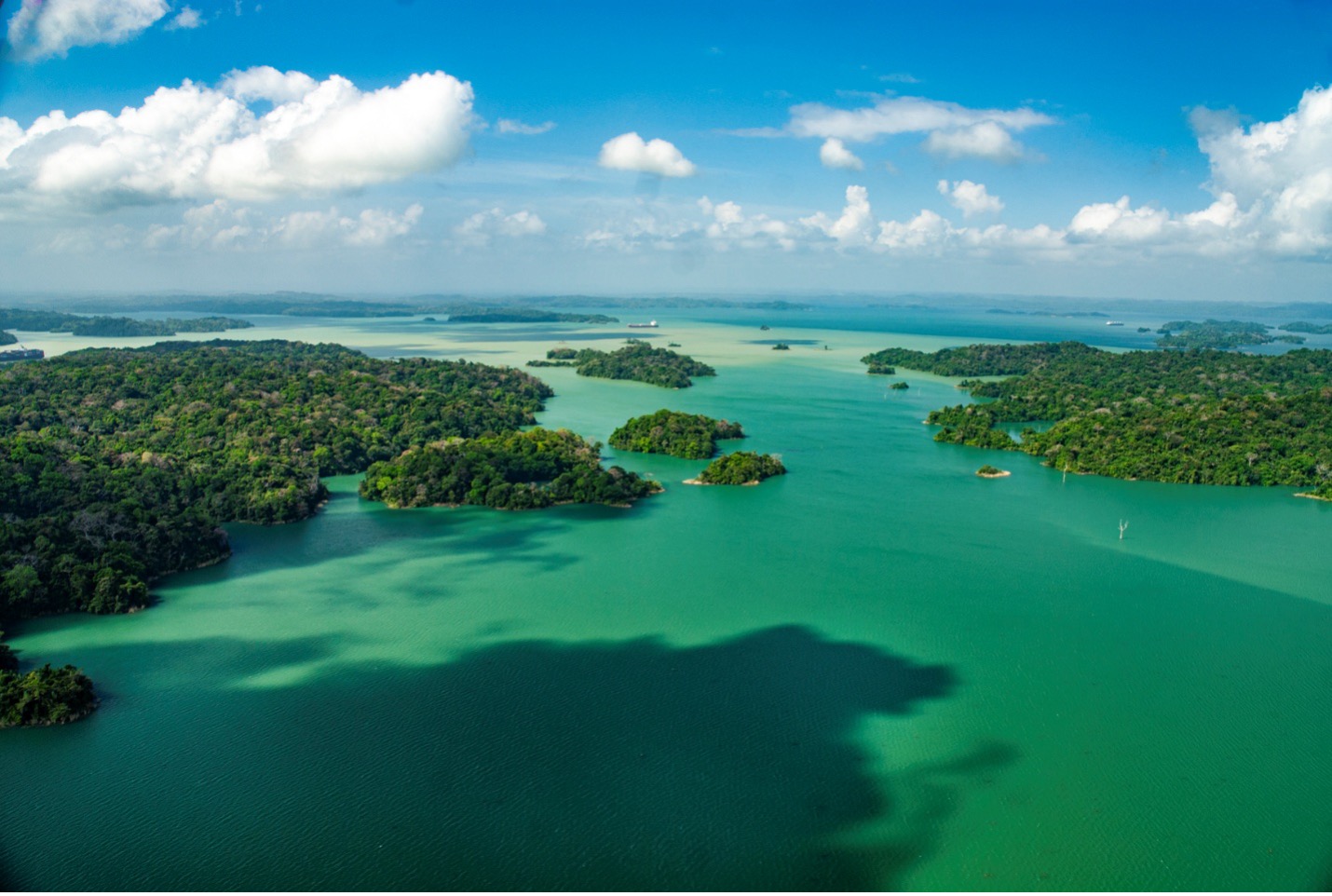
Aerial view of Lake Gatun. Photo by Luis Carlos Garcia.
Canal Zone
More than 75,000 workers from the Caribbean, Europe, and the Americas labored on the canal. Workers from Barbados and Jamaica performed the most dangerous and physically demanding jobs. Disease posed one of the greatest threats to construction, but U.S.-led public health campaigns targeted mosquitoes, dramatically reducing yellow fever and malaria. These efforts saved lives and represented a breakthrough in tropical medicine, even as dangerous working conditions continued. Although approximately 5,600 people died during construction, this was much lower than the number of deaths during construction of the railroad or the early French attempt to build a canal.
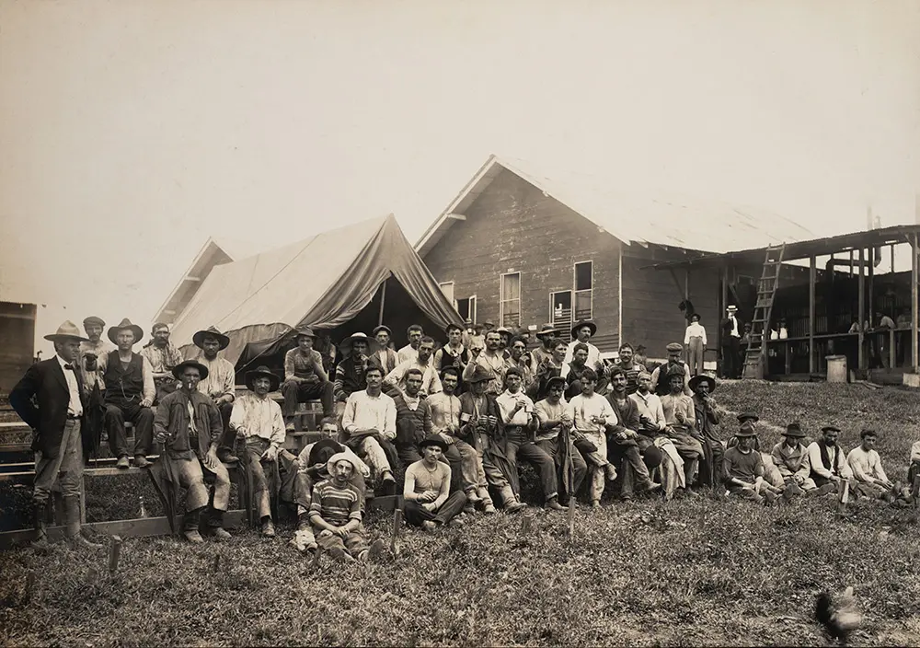
Group of workers from Spain. From 1906 to 1908, 8,300 workers were recruited from Spain to work on the Canal. Expecting to find nice houses, healthful food, and recreational facilities pictured in recruiters’ brochures, instead they found poor accommodations, unpalatable food, and long days in dangerous working conditions. Although paid twice as much as West Indian workers, they resented the segregated structure and organized several strikes. Image source: Nichols, Aurin Bugbee, and Tirzah Lamson Nichols. Panama Canal Collection, 1846-1923 (bulk 1906-1914). Photograph Album 2, p. [45].
The canal opened in 1914 and was controlled by the United States through the Canal Zone, a territory largely closed to Panamanians. Panama became a crossroads of global commerce. For much of the 20th century, the canal symbolized both modern progress and foreign domination.
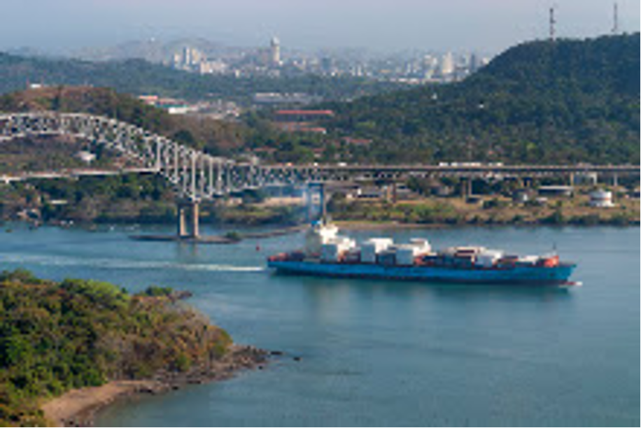
Cargo ship transiting the Panama Canal. Photo: Luis Carlos Garcia
The ship has just passed under the Bridge of the Americas near the Pacific entrance to the canal at Balboa. The skyline of Panama City is in the background.
Cargo ship transiting the Panama Canal. Photo: Luis Carlos Garcia
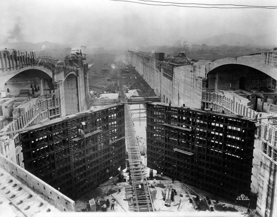
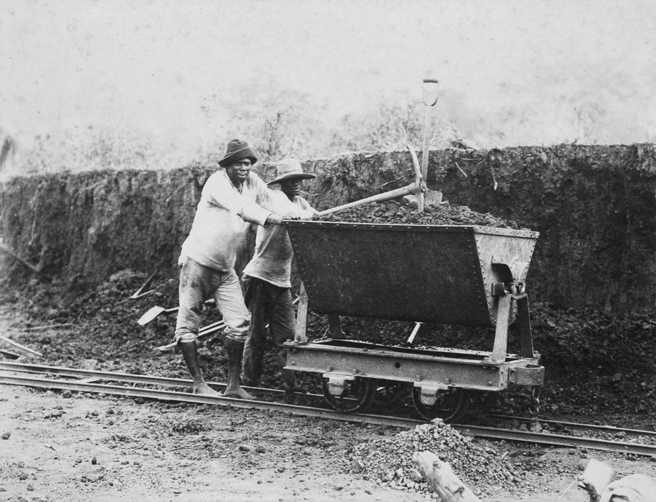
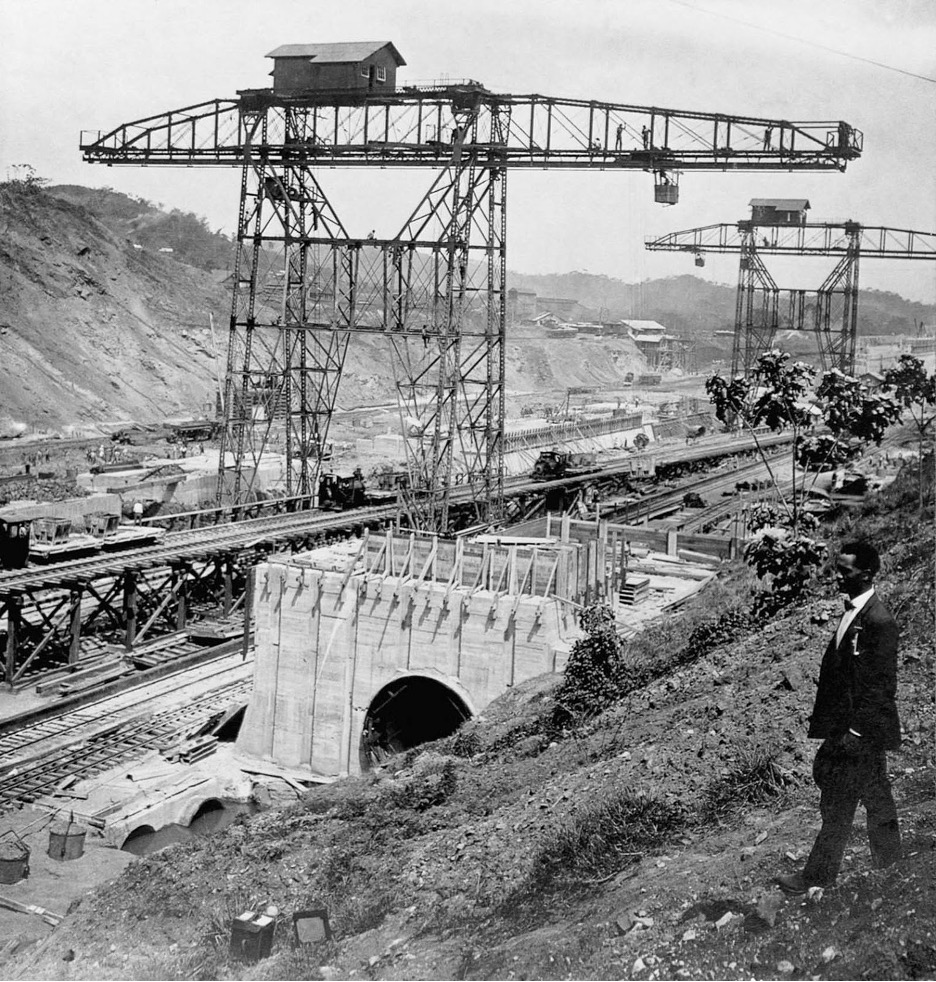
The Construction of Panama Canal in Rare Pictures, 1881-1914.
Source: rarehistoricalphotos.com
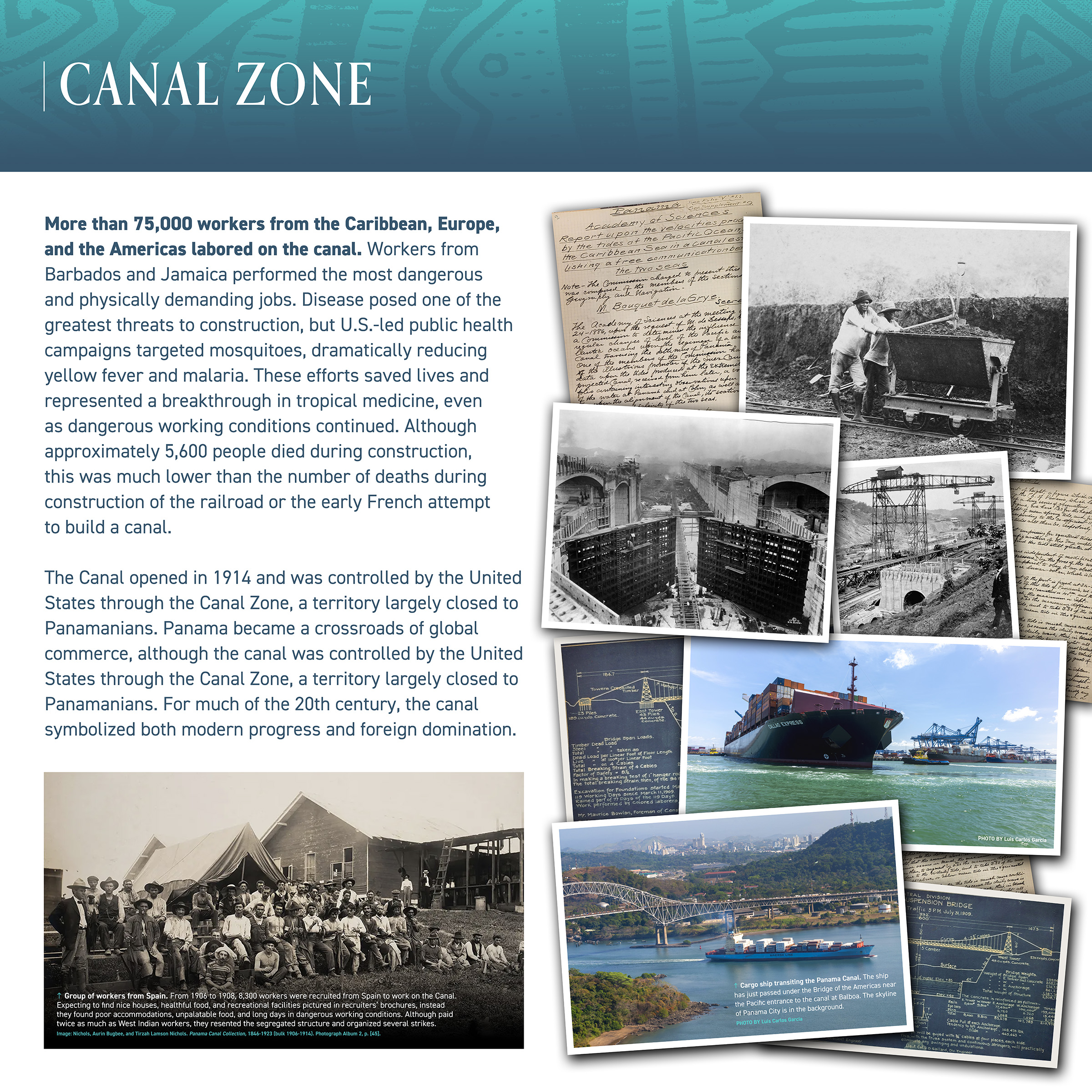
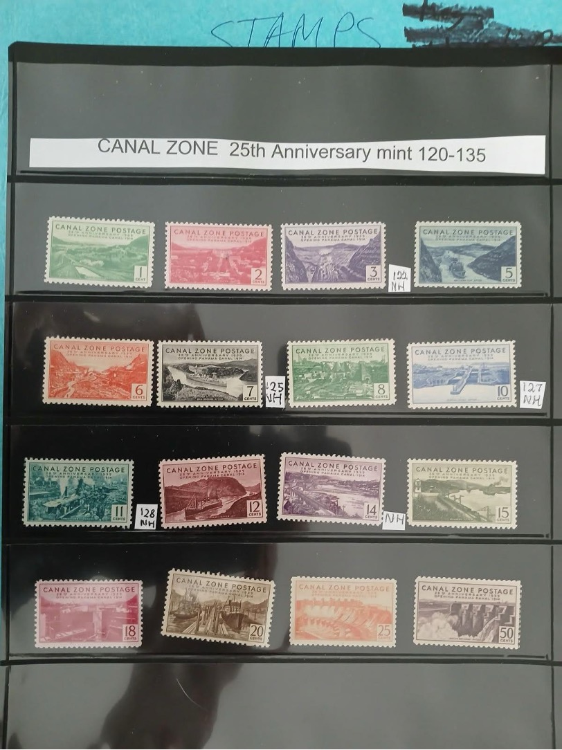
Canal Zone Postage Stamp
Canal Zone Postage One Cent
1939
For 25th Anniversary of Panama Canal Opening
Loan from Meg Newswanger
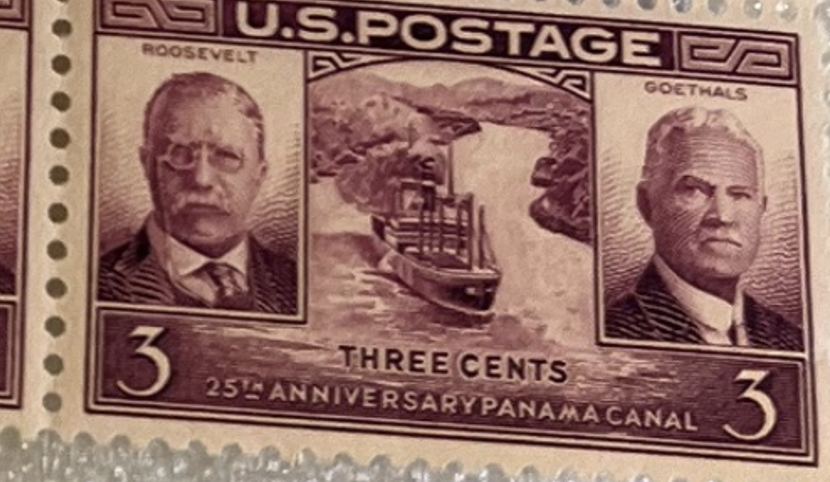
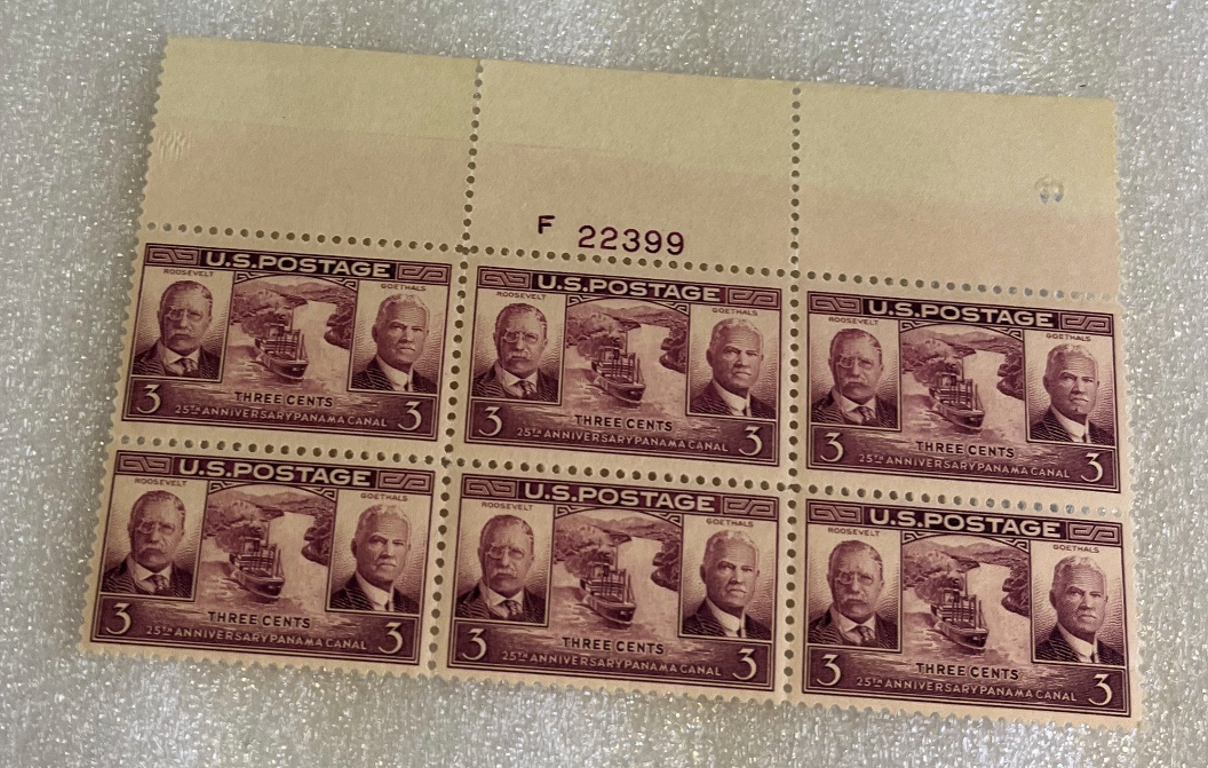
Roosevelt and Goethals Stamp Series
1939
For 25th Anniversary of the Panama Canal Opening
LACC Collection
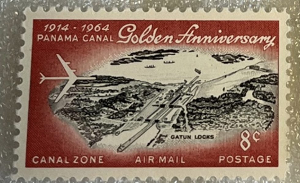
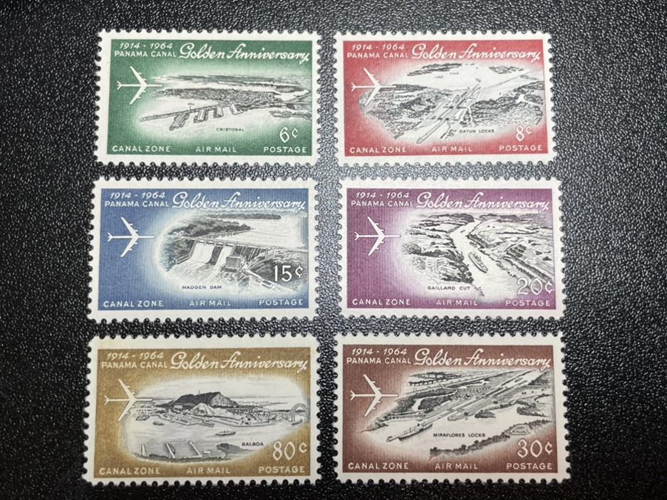
Canal Zone Air Mail Stamp Series
Canal Zone Eight Cents
1964
For Panama Canal Golden Anniversary, 1914–1964
LACC Collection
Stamps commemorating the 50th anniversary of the opening of the Panama Canal.
In 1977, U.S. President Jimmy Carter and Panamanian leader Omar Torrijos signed a treaty to gradually transfer control of the canal to Panama. This process was completed and on December 31, 1999, full control and operation of the canal was assumed by the Panama Canal Authority (ACP), an autonomous Panamanian government agency.
In 2016, the largest upgrade in the history of the canal was completed. Financed and managed by the Panama Canal Authority, the $5.25 billion Third Set of Locks Project allowed a new generation of massive ships to use the canal. The expansion included new lock chambers with rolling gates and, importantly, water-saving basins that recycle up to 60 percent of the water used in each transit of the canal.
The biggest threat to the Panama Canal is drought and rainfall variability that affects the water levels in Gatun Lake and Alajuela Lake. Each ship transit requires millions of gallons of freshwater, most of which is released into the ocean after use. In 2023-2024, a severe drought reduced reservoir levels to the point that there were significant delays for ships using the canal.
The Pan-American Highway and the Darién Gap
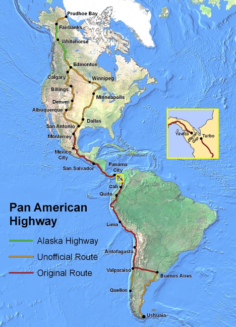
With a railroad and canal linking the Atlantic and Pacific Oceans, Panama has an outsized importance in the world, but it surprisingly lacks a land connection between North and South America. The idea of a hemispheric highway emerged in the 1920s. and formal planning began at the Fifth International Conference of American States in 1923. No single project was ever undertaken, but as countries built their own road transportation, the Pan-American Highway gradually became a reality. By the 1960s, most of the route from North to South America was drivable except for the rugged Darién Gap, which remains a roadless region.
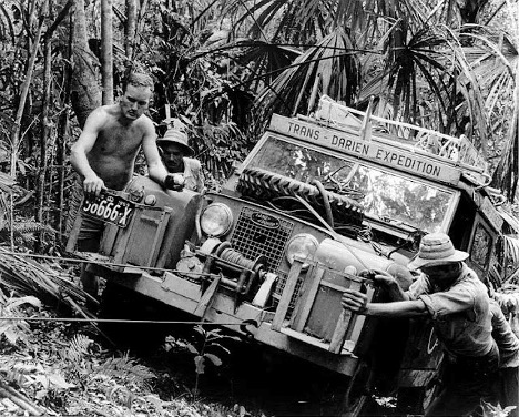
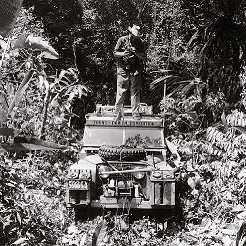
The Highway reaches its southeaster limit in Panama at Yaviza, and roughly 60-100 miles separate it from the Colombian city of Turbo on the Gulf of Urubá. Although there have been multiple proposals to build a road through the Darién Gap, none have resulted in a permanent highway connection. Efforts stalled due to extreme terrain and flooding, high construction costs, fears of deforestation, and strong opposition from indigenous communities.
Since the 1980s, large portions of the region have been protected as the Darién National Park in Panama and by Los Katios National Park in Colombia. Although a road through the region could be accomplished, the combination of a desire for environmental protection, respecting indigenous rights, and geopolitical caution have taken precedence over the need for continental connectivity.