

The First Europeans
Timeline
● 1501 Rodrigo de Bastidas explores what is now Panama
● 1502 Columbus sails along the coast of Panama seeking a passage to the Pacific Ocean
● 1510 A Spanish settlement is established at Santa María la Antigua del Darién
● 1513 Vasco Núnez de Balboa crosses the isthmus and sights the Pacific Ocean
● 1519 Panama City is founded, becoming Spain’s anchor on the Pacific
● 1671 Panama City is destroyed by pirates led by English privateer Captain Henry Morgan
● 1698 The Scots Attempt to Build a Colony in the Darién
● 1717 Panama is incorporated into the Viceroyalty of New Granada (based in Bogotá)
● 1739 Portobelo on the Royal Road is Captured during War Between Spain and Britain
● 1821 Panama Becomes Part of the Newly-Independent Gran Colombia
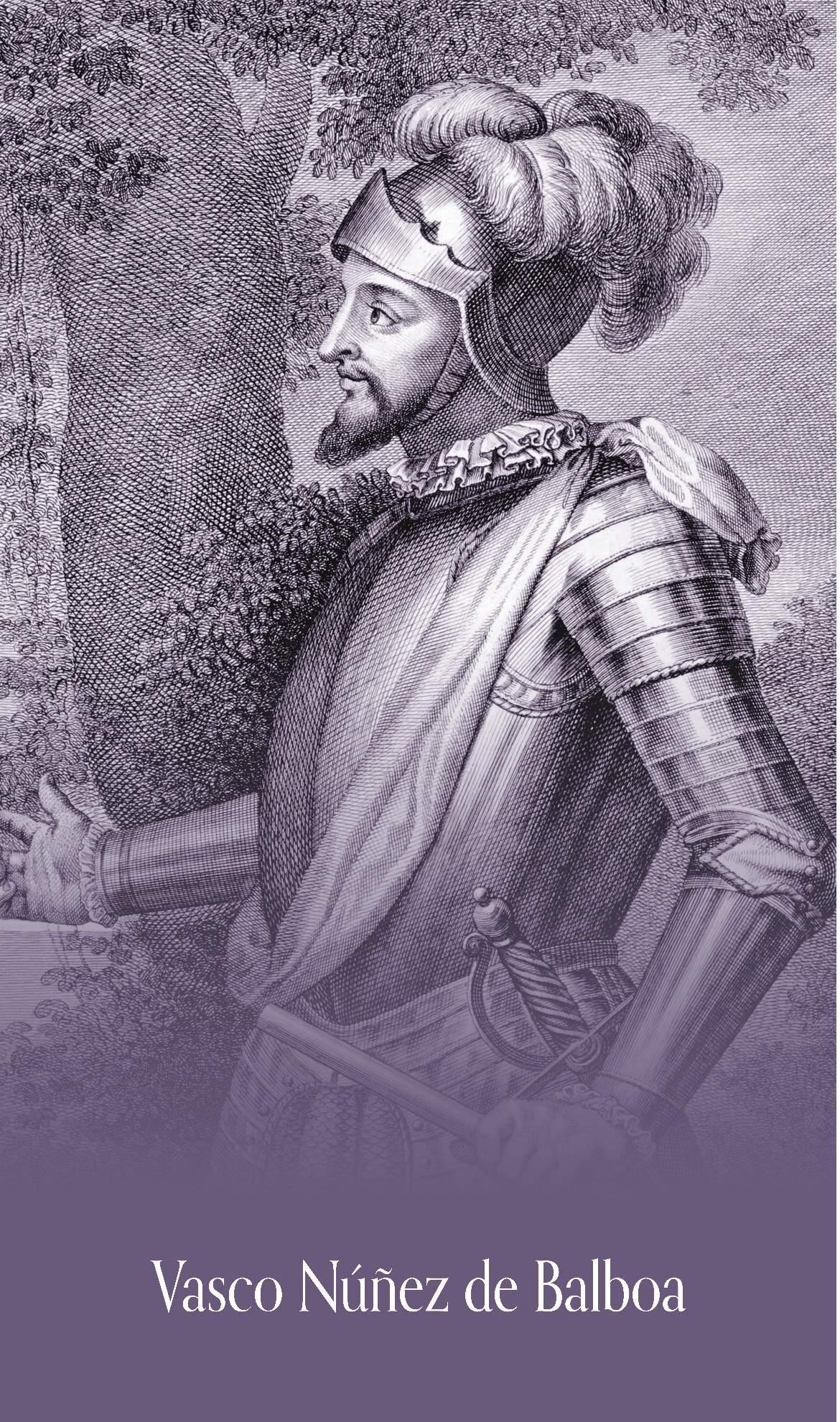
The Caribbean coast of Panama was first explored by Europeans in 1501 when Spanish navigator Rodrigo de Bastidas sailed along the isthmus, claiming the territory for Spain. Forced to abandon the expedition when shipworms severely damaged his vessels, Bastidas returned to Hispaniola. Among his companions was the future explorer Vasco Núñez de Balboa.
The following year, during his fourth voyage to the Americas, Christopher Columbus explored Panama’s Caribbean coast while searching for a passage to Asia. He visited the regions of Bocas del Toro, the Chagres River, and Portobelo (“Beautiful Port”), and briefly established a settlement at Santa María de Belén. Confronted by Indigenous resistance, disease, and deteriorating ships, Columbus ultimately abandoned the settlement and returned to Spain.
The Darién became one of the earliest centers of Spanish settlement on the mainland of the Americas. In 1510, Spaniards founded Santa María la Antigua del Darién near the Gulf of Urabá. The settlement became the headquarters of Vasco Núñez de Balboa, who forged alliances with certain Indigenous groups while attacking others in his search for wealth and territorial control. Guided by Indigenous accounts of a vast sea to the south, Balboa organized an expedition across the isthmus.
In September 1513, Balboa became the first European to view the Pacific Ocean from the Americas. After a difficult journey through dense forests and rugged terrain, he waded into the waters of the “South Sea” and claimed it, along with all adjoining lands, for the Spanish Crown. Although some portions of the isthmus are only about 30 miles (48 km) wide, the crossing remained a formidable challenge. By 1519, persistent Indigenous resistance and the unhealthy climate led the Spanish to abandon Santa María la Antigua and relocate to Nuestra Señora de la Asunción de Panamá (present-day Panama City), the first permanent European settlement on the Pacific coast of the Americas.
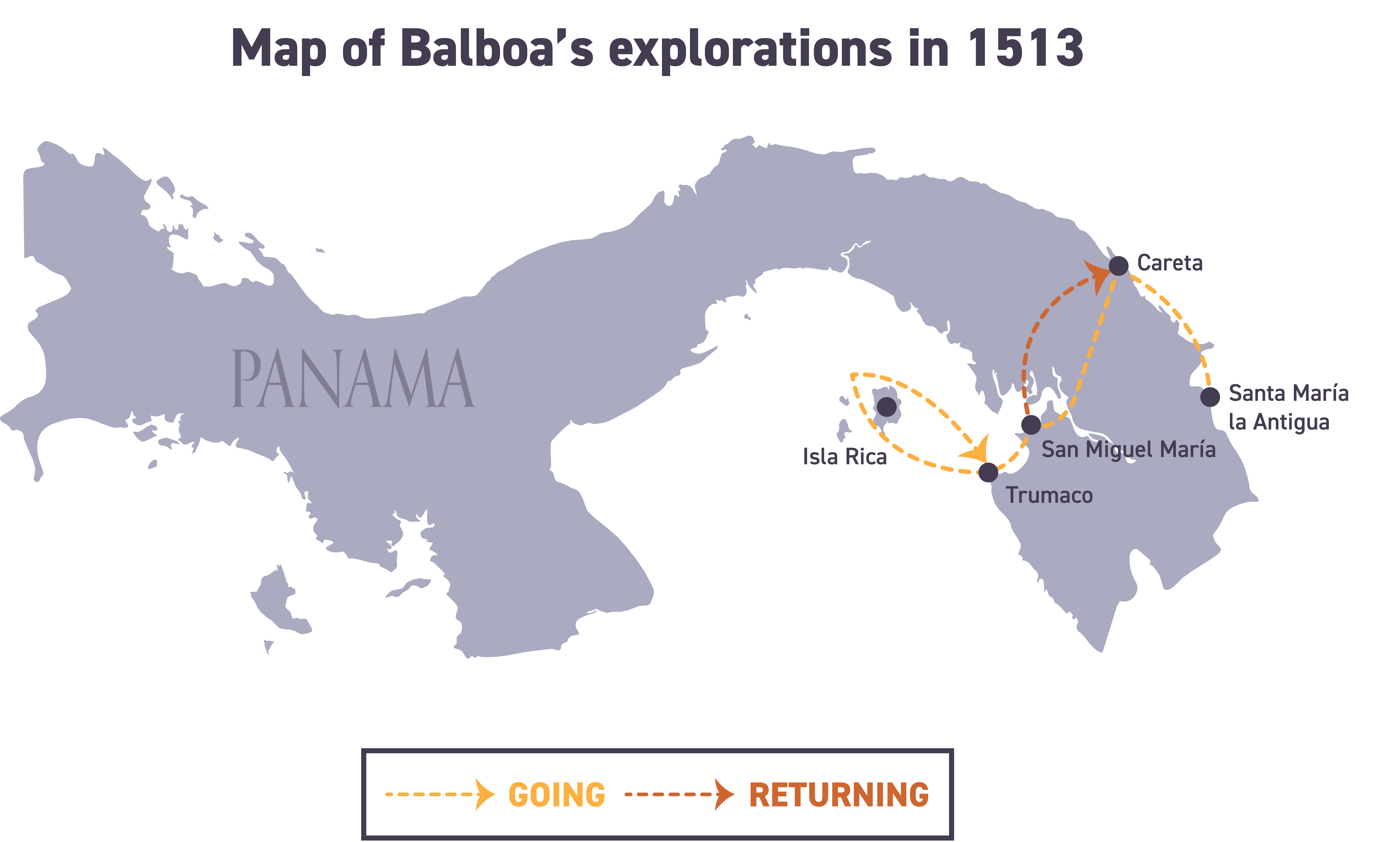
Map of Balboa’s explorations in 1513.
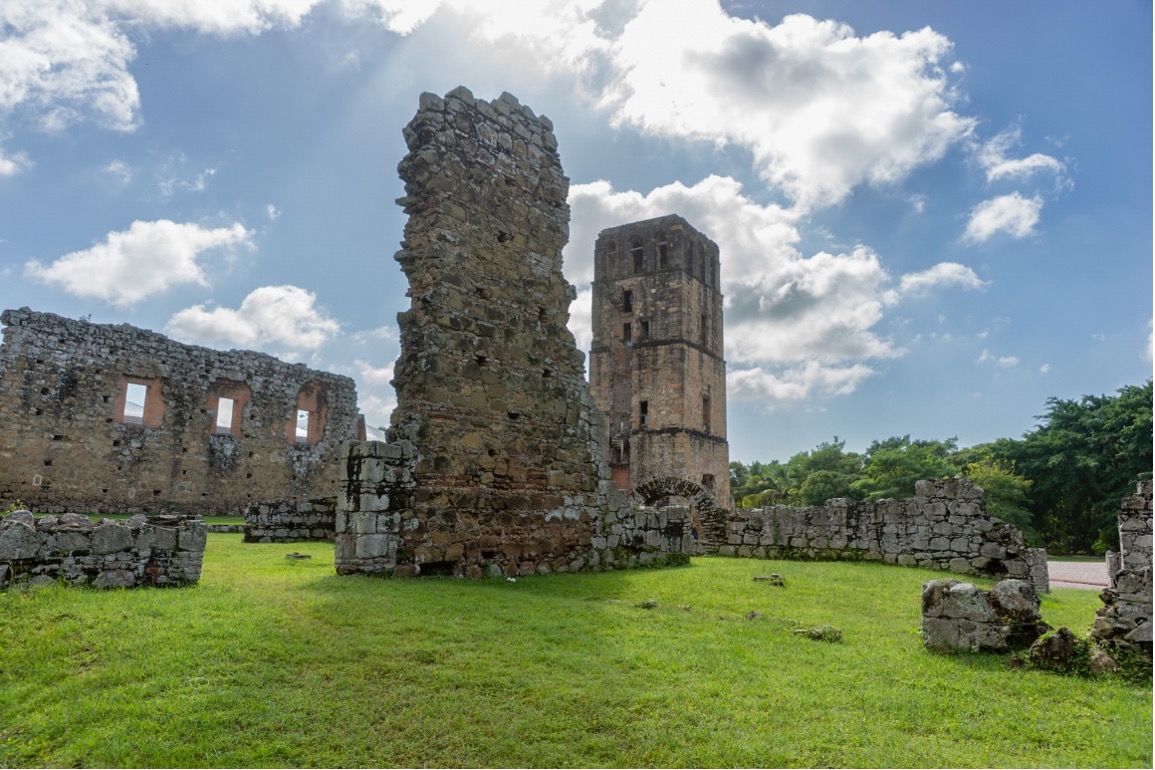
Ruins of the Cathedral of Nuestra Señora de la Asunción in the Historic Site of Panama Viejo. Founded in 1519, Panamá Viejo (Old Panama) was destroyed by Pirates in 1671. Now a World Heritage site, Panamá Viejo contains the ruins of the first European settlement on the Pacific Coast of the Americas.
Photo: Luis Carlos Garcia
A Link Between Oceans
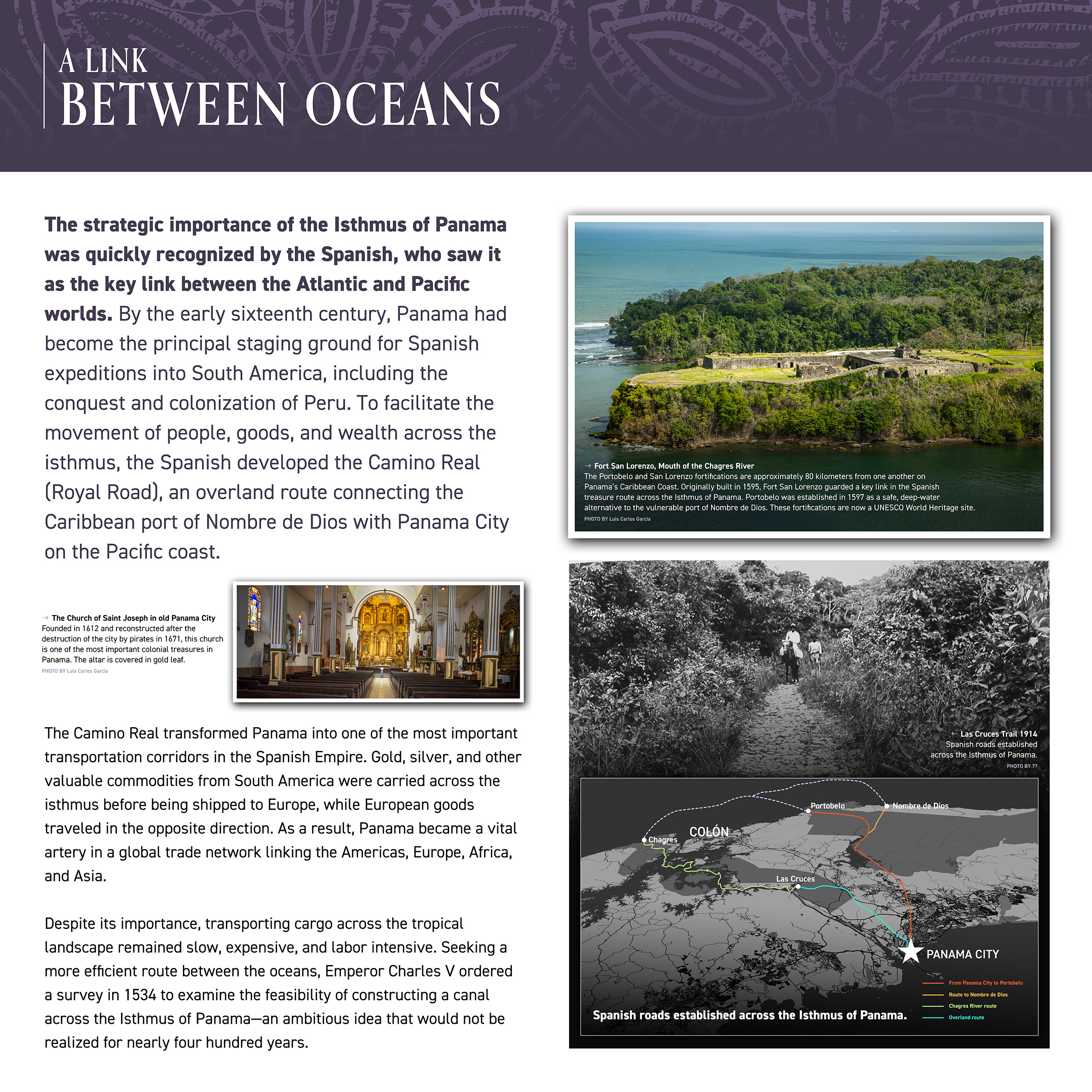
The strategic importance of the Isthmus of Panama was quickly recognized by the Spanish, who saw it as the key link between the Atlantic and Pacific worlds. By the early sixteenth century, Panama had become the principal staging ground for Spanish expeditions into South America, including the conquest and colonization of Peru. To facilitate the movement of people, goods, and wealth across the isthmus, the Spanish developed the Camino Real (Royal Road), an overland route connecting the Caribbean port of Nombre de Dios with Panama City on the Pacific coast.
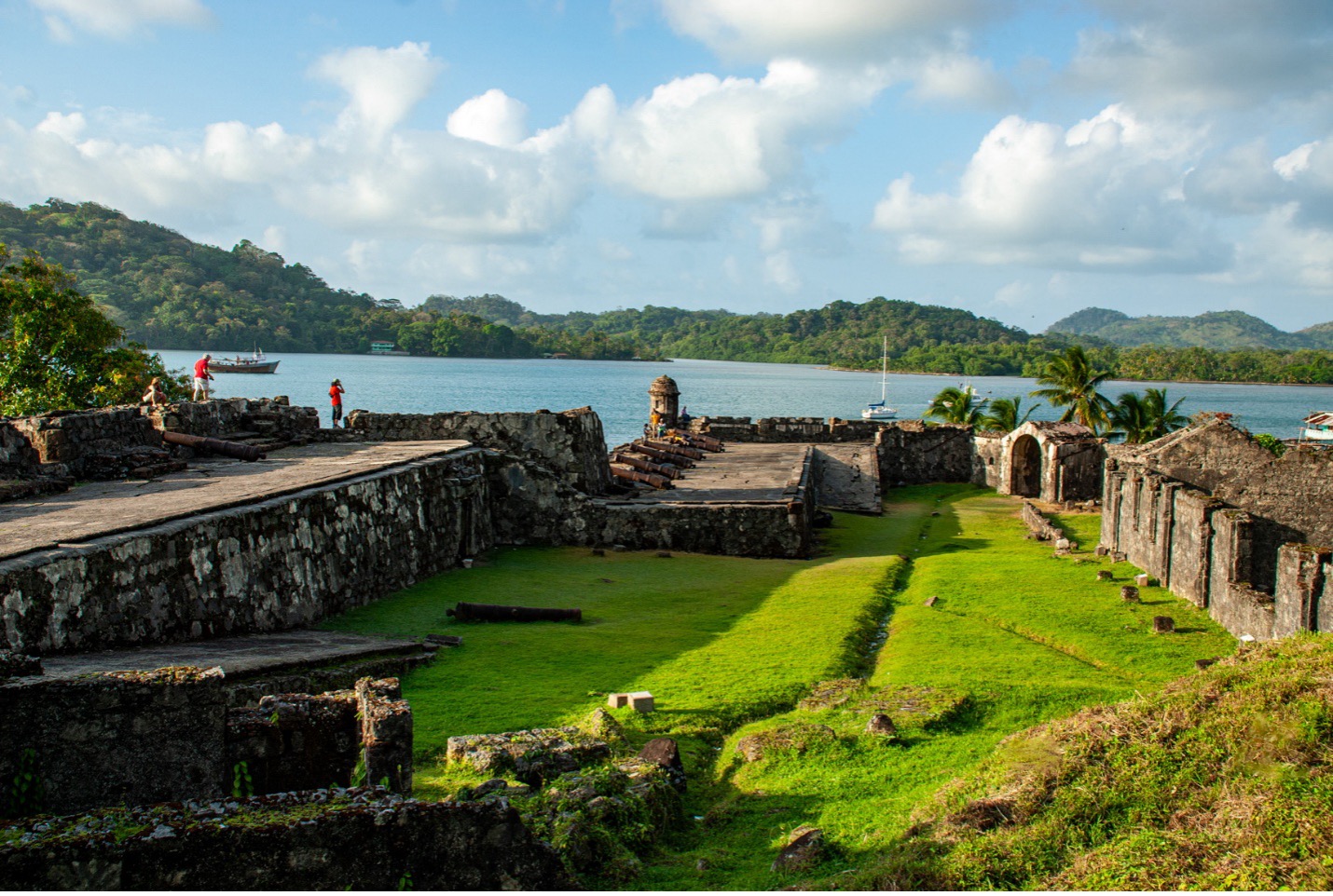
Fort San Lorenzo, Mouth of the Chagres River
Photo: Luis Carlos Garcia
The Portobelo and San Lorenzo fortifications are approximately 80 kilometers from one another on Panama’s Caribbean Coast. Originally built in 1595, Fort San Lorenzo guarded a key link in the Spanish treasure route across the Isthmus of Panama. Portobelo was established in 1597 as a safe, deep-water alternative to the vulnerable port of Nombre de Dios. These fortifications are now a UNESCO World Heritage site.
The Church of Saint Joseph in Panama Viejo
Photo: Luis Carlos Garcia
Founded in 1612 and reconstructed after the destruction of the city by pirates in 1671, this church is one of the most important colonial treasures in Panama. The altar is covered in gold leaf.
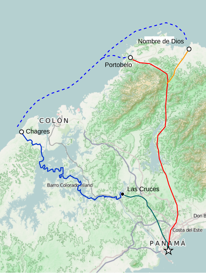
Commercial Spanish Colonial Routes Across the Isthmus of Panama
▬▬▬ Camino Real de Portobelo (from Panamá City to Portobelo)
▬▬▬ Camino Real de Nombre de Dios
▬▬▬ Camino Real de Cruces (using the Chagres River)
▬▬▬ Camino Real de Cruces (footpath)
The Camino Real transformed Panama into one of the most important transportation corridors in the Spanish Empire. Gold, silver, and other valuable commodities from South America were carried across the isthmus before being shipped to Europe, while European goods traveled in the opposite direction. As a result, Panama became a vital artery in a global trade network linking the Americas, Europe, Africa, and Asia.
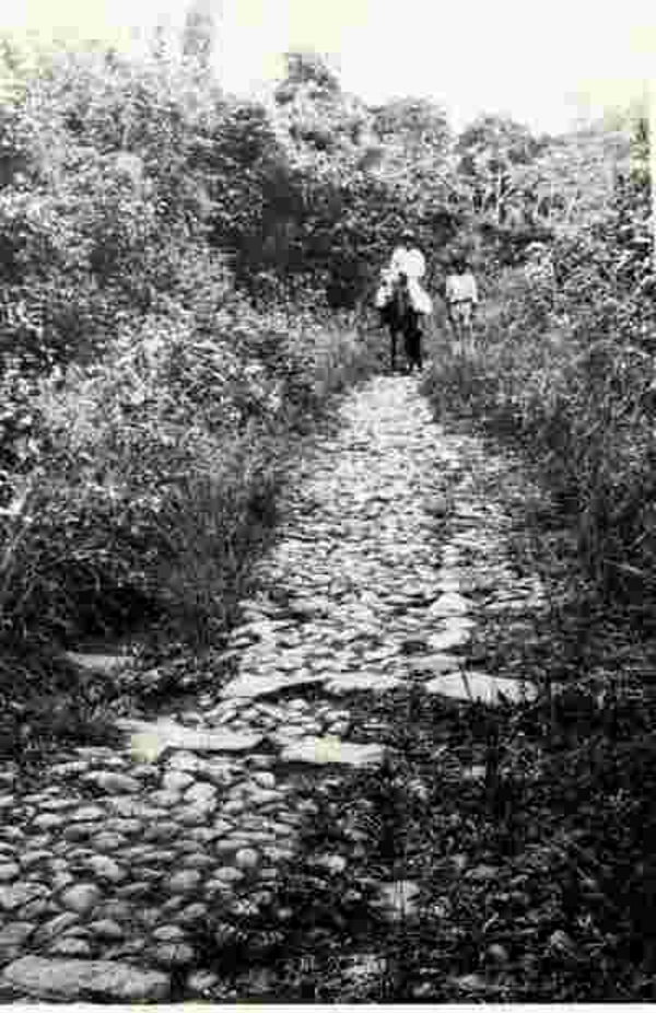
Las Cruces Trail circa 1914. This was one of the Spanish roads established across the Isthmus of Panama.
Despite its importance, transporting cargo across the tropical landscape remained slow, expensive, and labor-intensive. Seeking a more efficient route between the oceans, Emperor Charles V ordered a survey in 1534 to examine the feasibility of constructing a canal across the Isthmus of Panama—an ambitious idea that would not be realized for nearly four hundred years.